
Sanborn Maps of Pine City
|
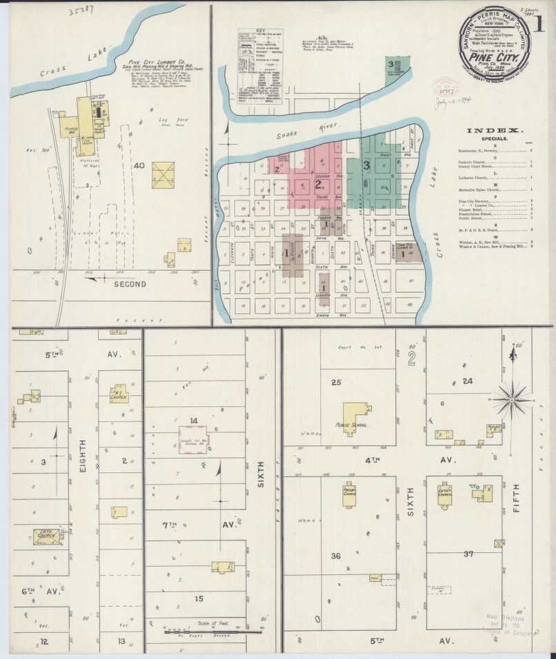
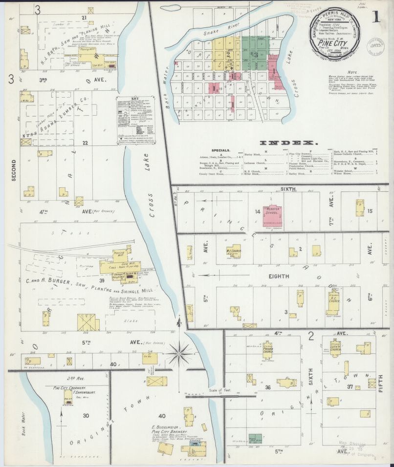
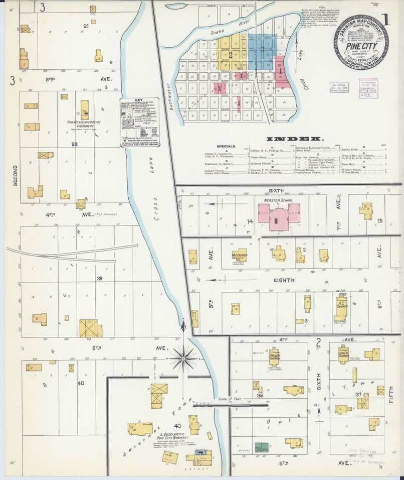
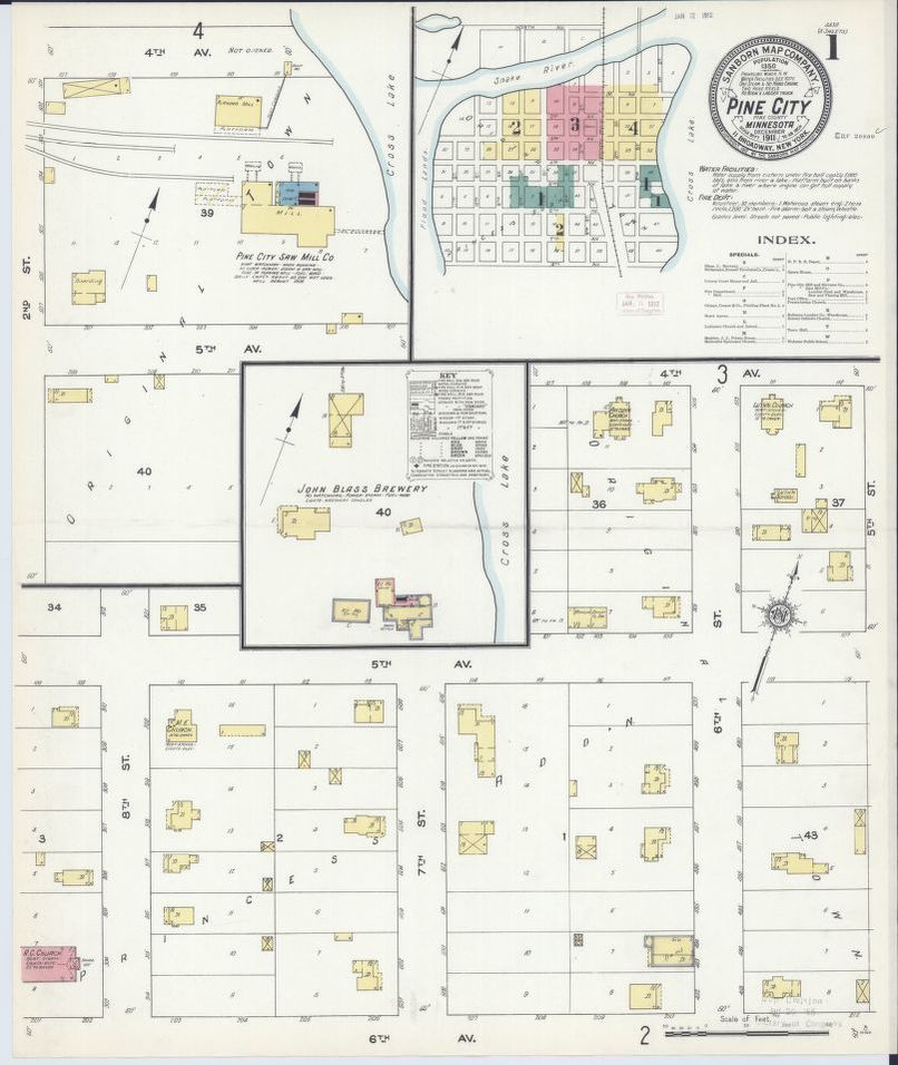
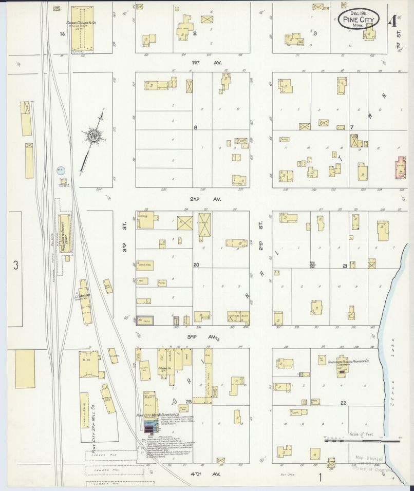
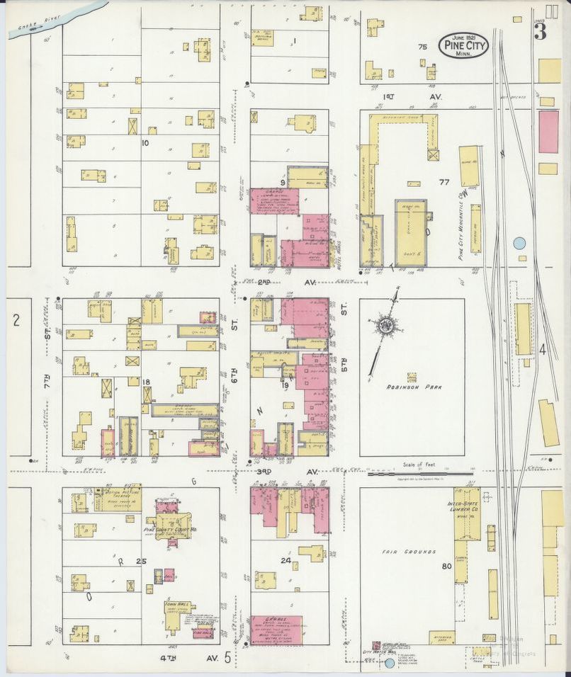
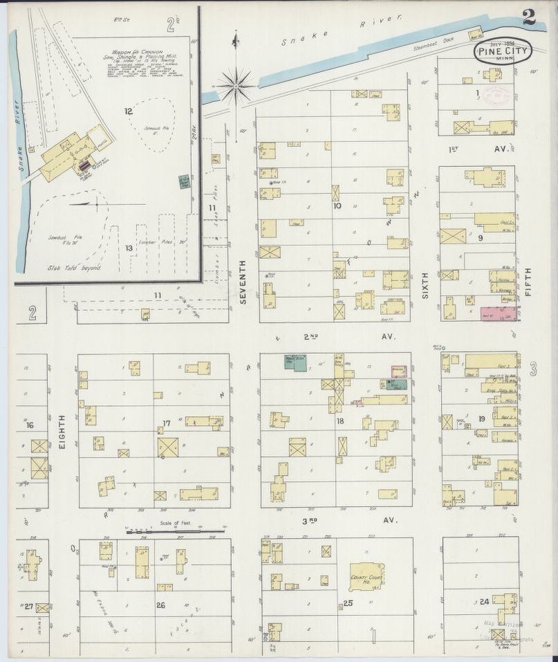
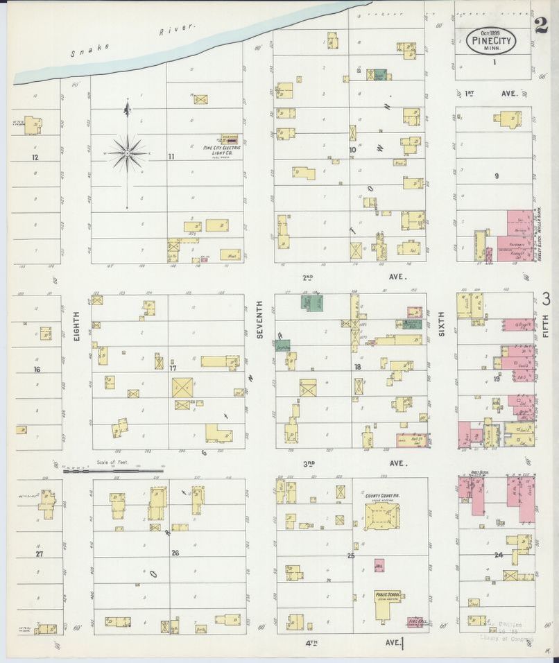
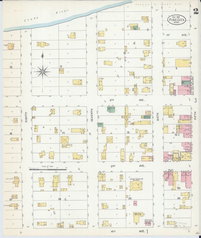
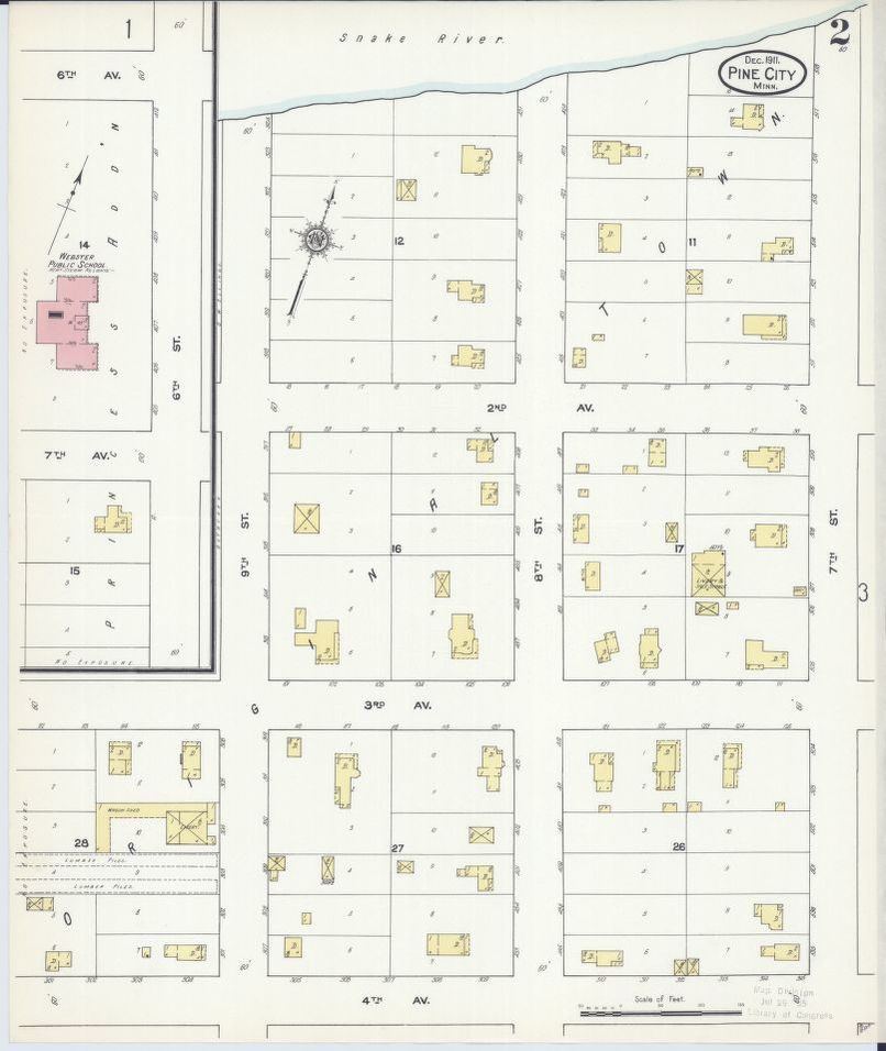
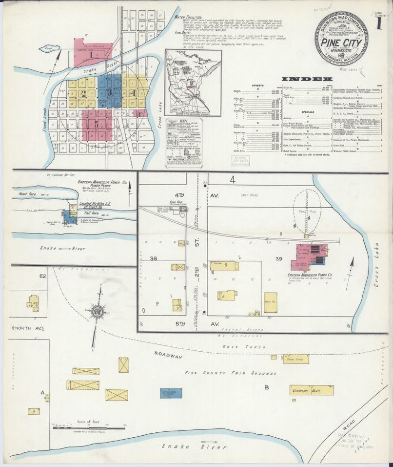
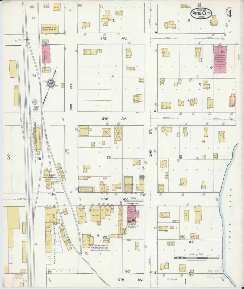
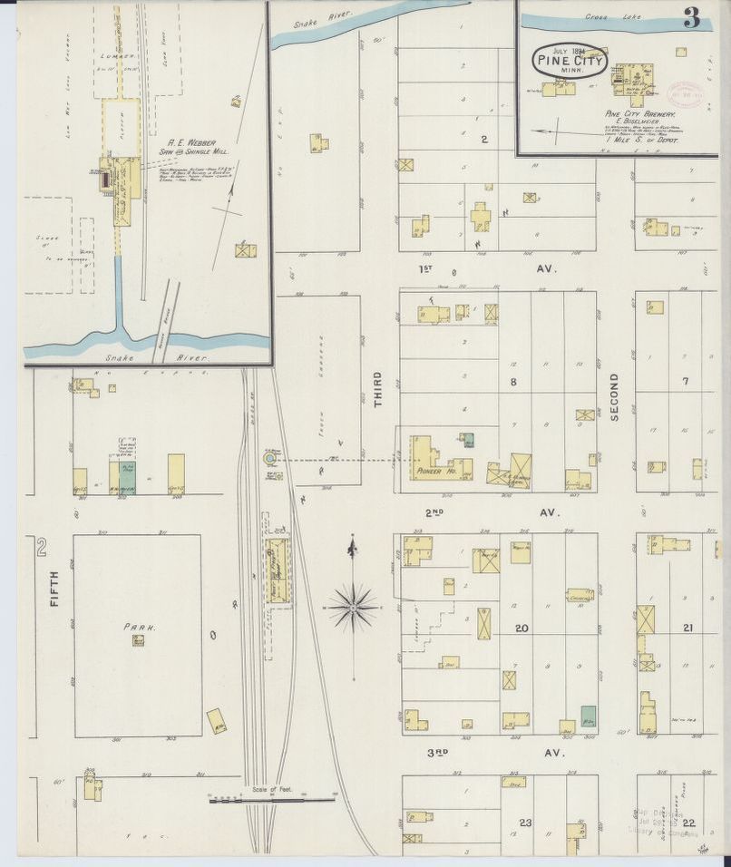
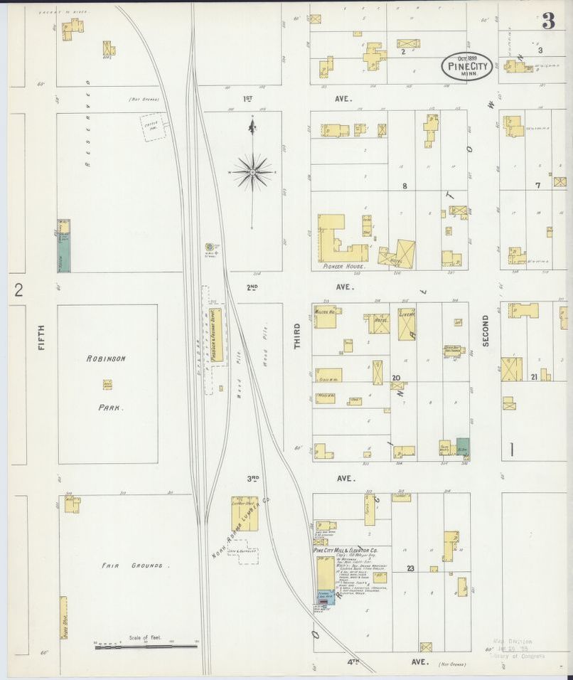
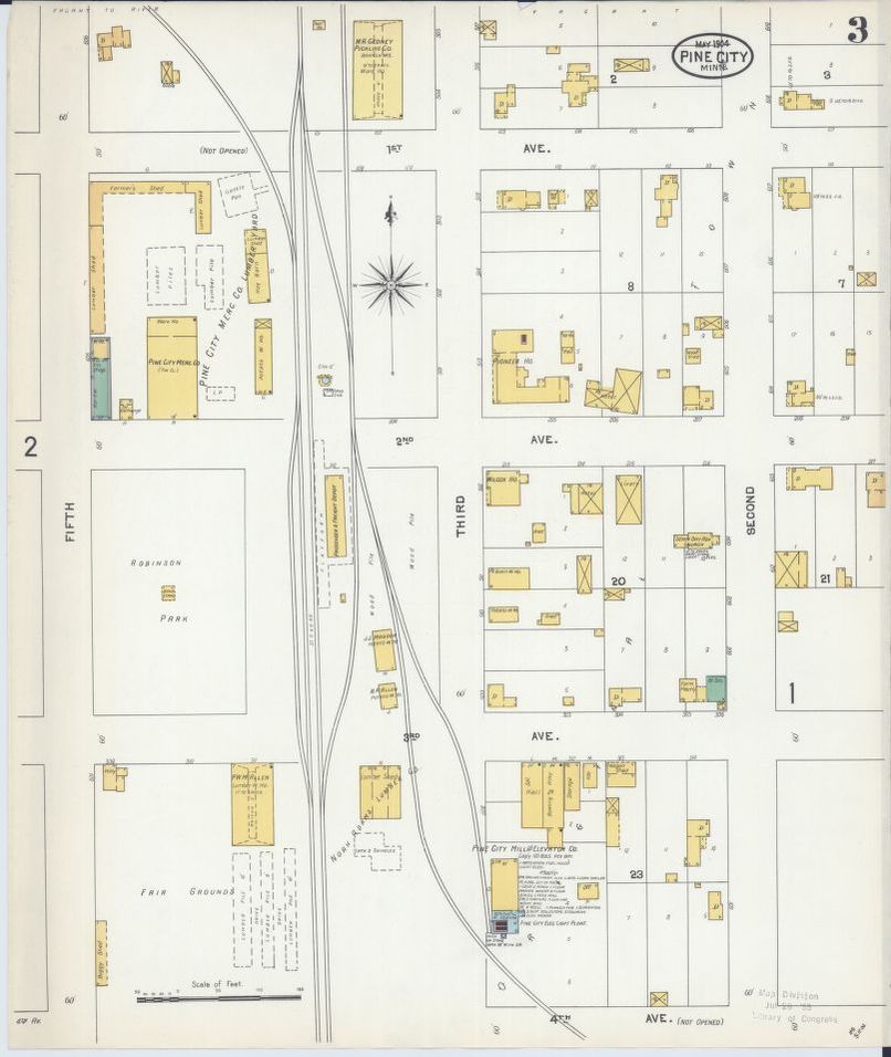
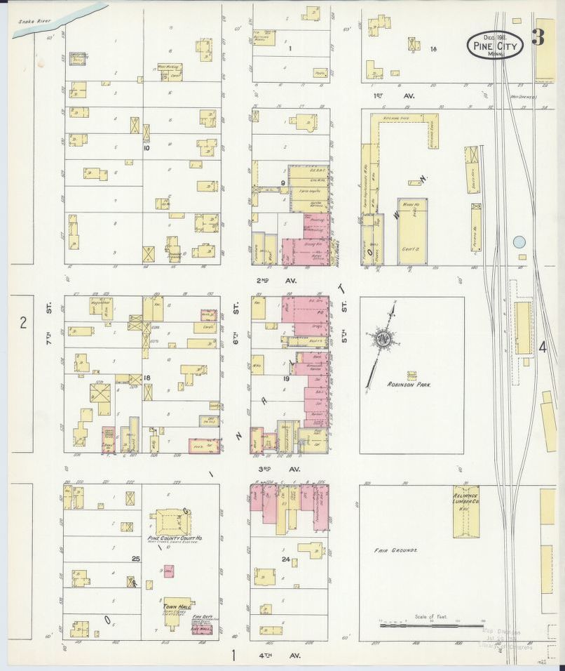
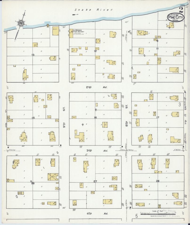
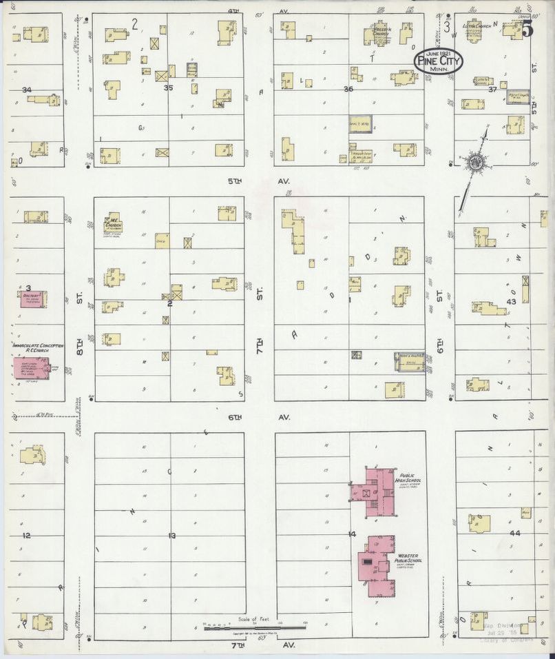
The Sanborn Map Publishing Company produced amazing fire insurance maps across North America from 1867 to 1969. Sanborn Maps were designed to assist fire insurance agents in determining the degree of hazard with particular properties. As such they were most concerned with commercial properties and did not cover the whole town. They are a wonderful glimpse into the evolution of a property. The maps below are links to maps on the Library of Congress's site that allow you to zoom in for a close up view.
|
The two sites here have excellent explanations about the Sanborn Maps.
|


|
Sanborn Maps by Year - below
|
|
1894 Sanborn Map 1
1899 Sanborn Map 1
1904 Sanborn Map 1
1911 Sanborn Map 1
1911 Sanborn Map 4
1921 Sanborn Map 3
|
1894 Sanborn Map 2
1899 Sanborn Map 2
1904 Sanborn Map 2
1911 Sanborn Map 2
1921 Sanborn Map 1
1921 Sanborn Map 4
|
1894 Sanborn Map 3
1899 Sanborn Map 3
1904 Sanborn Map 3
1911 Sanborn Map 3
1921 Sanborn Map 2
1921 Sanborn Map 5
|